Tadiandamol is Karnataka’s 3rd highest peak and a popular destination for trekking lovers in South India. Tadiandamol stands 1780 meters high amid the famous Shola forest of Karnataka. On my second visit to Coorg, I decided to scale Tadiandamol and it turned out to be another exhilarating trekking experience.
I have been to Coorg in Jan’19 as well and had covered the tourist attractions. Well, when I go back to a destination again, I prefer to see the unexplored parts of it rather than revisiting the same places all over again. While making the itinerary I knew this time it has to be all about off-beat places.
There are so many options for trekking nearby Coorg from Nishani Motte & Mandalpatti to Tadiandamol. So, I did little research to and I settled for Tadiandamol.
Table of Contents
Journey from Bangalore
Coorg is only 250 KM from Bangalore and I went along with my cousins this time. We had hired a cab, again there were 6 of us so it would be cheaper to travel by cab. Starting early at 4 AM we reached the destination by 9 AM, thanks to lesser traffic.
3 days’ itinerary to cover all offbeat places in Coorg. So, the day we reached Coorg we went to Namdroling Monastery and Chkilihole Dam for a witnessing beautiful sunset. Read more about the same at E-tramping where I have dedicated one entire blog on offbeat places in Coorg.
How to Reach Tadiandamol?
There are plenty of buses running from major cities of Karnataka (Bangalore, Mangalore, Mysore, and others) to Coorg. The bus stand is in the main town of Madikeri from where the base point of Tadiandamol Trek is 35 KM. Please note there is no public conveyance for the base point hence you either have to hire a private cab or an Auto Rickshaw. Coorg doesn’t have Railway Station and Airport. The nearest Railway Stations are Mysore & Mangalore, 117 KM & 135 KM respectively. The nearest Airports are also in the same cities, 144 KM & 132 KM respectively. To reach Coorg, again you have to take a Cab or a Bus from the said cities.
Where to Stay in Tadiandamol?
Nalknad Palace is the base point for Tadiandamol Trek and it is 35 KM from Madikeri Bus Stand. If you’re solely going for the trek, I would advise staying in Madikeri, the reason is there is no public transport for Nalknad Palace, and you need to go by Cab or an Auto Rickshaw. It will be easier to find one in the main town rather than anywhere else. But if you have planned to visit other places also then you can consider other locations as well for stay. Tad
Apt Time to Visit Tadiandamol
The best time to scale Tadiandamol is from October to February. Monsoon season end post-September, which means you will see greenery all around. Please avoid going during the Monsoon, as it heavily in this region making trekking very difficult.
Tadiandamol Trek: All you Need to Know
- Firstly, a lot of people have this question if this trek requires a guide. No, this trek can be easily taken up on your own. Paths are well marked, and you would be able to ascend the peak without straying away. The only thing to keep in mind is that this trek has steep terrains right from the very beginning which makes it slightly challenging.
- The total distance of the trek is 12 KM, to and fro from the base point at Nalknad Palace. You can cover the entire distance in 6-7 hours depending on your pace. I recommend starting early in the morning anytime between 8:30 AM to 9:30 AM.
- Once you enter the forest area, you’re supposed to come back by 3 PM. As the trek goes inside from Shola Forest, there is a chance of being attacked by wild animals. So, start early for the trek so that you come out on time. This would also mean that you will find a lesser crowd on the peak which gives you the chance to click better pictures.
- Pack Light!!! Don’t burden yourself with unnecessary things. Carry a small backpack with all the essentials. There are no shops mid-way except for one at the forest checkpoint. Carry your water bottles and energy bars to keep yourself energized throughout the trek. The trek is a bit challenging, the lighter you pack the better it is.
- Raincoats and sunglasses are a must, the weather keeps on changing drastically. You will need both things for sure!!!

Climbing up through the Steep Terrains.
Nalknad Palace: The Base Point for Tadiandamol Trek
From Zostel (where we stayed) Nalknad Palace was 46 KM far, a good 1.5 hours of drive. So, we planned to leave at 7 AM from Zostel and have breakfast at Nalknad Palace. Please note there are no shops even at the base point and usually in South India, you will not find good breakfast places during early morning hours. So, what we did was, we bought some fruits and bread & butter a night before and ate the same in the morning before the trek. After a good filling breakfast, we were ready to start the trek.
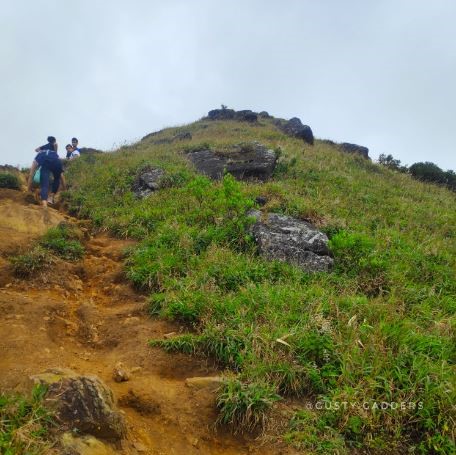
As we started the trek, we knew within a few kilometres of walking that it’s not going to be an easy one. For the first 2 KM, there is a proper concrete pathway to walk on but after that, it’s all muddy. Also, even though the pathway is concrete it’s quite steep as if you’re running on a treadmill on high inclination. And this is your impromptu leg day!!!
The terrain further went through parts of the forest, we found a few water streams. Those were small ones, not brimming with water. I guess they are livelier during the monsoons.
About Tadiandamol Trek
There is a forest area checkpoint which is 3 KM away from the base point. Every now & then we had doubts about whether we were heading in the right direction or not. We eventually figured out that there were no turns that we could have possibly missed, also the path is well marked which reassured us about the direction.
Forest Checkpoint
Finally, we reached the forest checkpoint, the entry fee per person is 50 INR. Policemen at the checkpoint would ask you to provide the contact number, they call you later to ensure that you have left the forest safely. As we moved ahead, terrain went from inside the forest and we had to jump over the tree roots that are protruding outside the soil. These roots had formed steps all over the way helping trekkers to move without much difficulty.
Breathtaking Views of Tadiandamol Hills
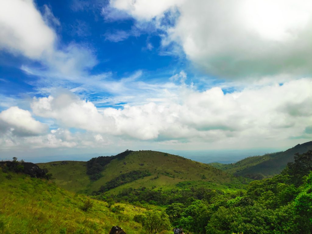
After the checkpoint, we had another 3 KM to cover, not as easy as it sounds!!! We moved ahead and spotted some hilltops which we assumed to be the peak. But no, this entire stretch took another one and a half hours to be covered. The stretch went up through the vegetations of the forest towards the peak. Very tedious but the views were breathtaking. There were steep slopes where we had to push ourselves to keep moving. Now and then majestic views were treating our eyes.
The landscape of the place was spectacular; the magnificent hill ranges all covered with monsoon fresh vegetation allured us. Nature is miraculous and Tadiandamol is probably one of the best places to notice this. The weather kept on changing within a few minutes. The last leg of the trek was so exhilarating and scary at the same time. There’s a particular slope with absolutely no reliable rock to hold the grip on and you have to go up crossing this 100 meter of terrain. Some of the trekkers slipped and rolled down, thankfully they escaped uninjured.
Tadiandamol Peak
Once we crossed this terrain and reached closer to the peak, nature was ready to greet us with breathtaking views of the Tadiandamol Hill and its surroundings. We found ourselves amidst the clouds and mist. Soon, we were on the peak where there was a hoarding declaring “Tadiandalmol Peak- 0 KM”. And I must tell how I felt to be on cloud 9, quite literally.
Tadiandamol Peak.
I won’t say it was an easy trek, it requires a lot of patience and stamina. But the views were worthy of all the pain and endurance. We spent around 45 minutes on the peak, clicking pictures and just existing in the beautiful world. There were only a few trekkers but as we started to descend suddenly the rush poured in. So, make sure you’re there early and enjoy the serenity to the fullest.
As soon as we started descending light shower poured in. We stopped at the checkpoint and enjoyed “the evergreen Maggi” while it rained heavily. After waiting for some time we put on our raincoats and continued to descend to reach the base point on time. On our way back we noticed all the small streams were brimming with the water then, rainfalls add a pinch of magic everywhere.

